
Project Portfolio
|
Current Projects
Stantec workflow review, GIS mapping, and performance of ALTA Surveys and Phase I ESAs for Lake County Brownsfield program Northern Energy and Power & Konisto Companies construction staking for site grading, solar panel arrays, piers, inverters, fences, roads, as-builts Evergreen Land Company field surveying/GIS mapping of planning/zoning maps, mining claims, roads/trails, resort layout Lake County Open Space Initiative mapping and due diligence for open space initiative property acquisition Local Real Estate/Title Agencies and Private Clients complete Professional Land Surveying (PLS) services |
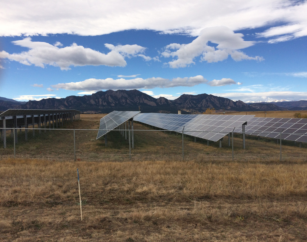
solar array site in Boulder, CO
|
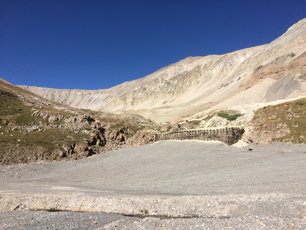
Sherman Mine in Leadville, CO
|
Recent Projects
Climax Molybdenum Company/Molleur Construction grade staking and as-built survyeing for Jones Gravel Pit reclamation project Lidstone and Associates, Inc. placement of ground control panel points for liDAR data collection at the Sherman Mine reclamation project Lake County Assessor development and maintenance of a GIS geodatabase including creation of new parcel, zoning, geologic, & FEMA features Eagles Nest Condominiums topography, subdivision, and condominium mapping of 9 lot/building condominium complex Frontier Environmental Services, Inc. field surveying of soil reclamation, river/pond restoration, mine reclamation, groundwater remediation, and trout habitat creation sites including creation of exhibits, cross-sections, and topographic maps |
Past Projects
- Lake County Community Park - boundary surveying and sewer line as-builts surveying
- Lake County Snowmobile Club - boundary surveying for snowcat storage, GIS mapping of winter trails system
- Leiter Field/Huck Finn Skatepark - topographic surveying for new construction
- Lake County Commissioners - surveying of various water storage reservoirs and land exchanges and layout of solar facilities
- Lake County Road And Bridge - staking of redesign/regrade of county parking area, grade staking of solar array sites
- Lake County Building and Land Use - review of lot consolidation/lot line adjustment/subdivision plats
- Parkville Water District - creation of GIS maps for water collection basins, distribution lines, and district boundaries
- Donala Water District - boundary surveying
- American Environmental Consulting - topographic surveying of Lake County landfill for expansion design
- Camp, Dresser, and McKee, Inc. - topographic surveying of Leadville Contaminated Soil Repository site for design
- Upper Arkansas Water Conservancy District - performance of level loops for UAWCD stream gauges
- SourceWater Consulting - field surveying of monitoring well locations
- Lake County/Cloud City Ski Club Dutch Henri Hill - land surveying for property transactions and site layout for Dutch Henri Hill ski, snowboard, and tubing park
- Lake County Office of Emergency Management - development and maintenance of a mapbook depicting all Lake County roads, addresses, and points of interest.
- Leadville Trail 100 - creation of GIS maps of Leadville Trail 100 "Race Across the Sky" routes
- True Value Hardware Phase I ESA - The True Value Hardware Phase I ESA provides a summary of recognized environmental conditions (REC) as required by ASTM Standard E1527-05.
- Quincy Block Condominiums - condominium mapping of the historical Quincy Building in Leadville, CO.
- Homestake Subdivision - development of site plans, landscaping, elevations, and marketing materials.
- Gore Range Surveying, Eldridge Land Surveying, & Andrew P. Cruise Surveying - Gore Range Surveying, Eldridge Land Surveying, & Andrew P. Cruise Surveying are surveying firms that provide topographic maps, improvement location certificates, land survey plats, ALTA Survey Plats, condominium maps, exhibits, and other land survey related documents. Great Divide Consulting has been contracted to assist in the completion of all of the above.
- Land Art- field surveying for landscape design purposes.
- Salcat Properties Phase I Environmental Site Assessment (ESA) - The SP Phase I ESA provides a summary of recognized environmental conditions (REC) as required by ASTM Standard E1527-00.
- Salida Public Works Department (SPWD) Phase I ESA - The SPWD Phase I ESA provides a summary of recognized environmental conditions (REC) as required by ASTM Standard E1527-00.
- Trans Moya Aqua (TMA) Global Wind Energy Systems (GWES) Phase I ESA - The TMA GWES Phase I ESA provides a summary of REC as required by the ASTM Standard E1527-00.
- Parkville Water District (PWD) Phase I ESA - The PWD Phase I ESA provides a summary of REC as required by ASTM Standard E1527-00.
- Upper Arkansas 208 Water Quality Plan - The 208 Water Quality Plan provides a summary of existing information that characterizes the 1) point sources of pollution and the 2) non-point sources of pollution to the drinking water watershed within Lake County. This effort was completed as partial fulfillment of the Section 208 requirements within the Clean Water Act, which promulgates the investigation, evaluation, and assessment of pollution sources within watersheds of variable use within a given county. Great Divide Consulting was contracted through the Upper Arkansas Area Council of Governments to assist in the completion of water quality plans for the counties of Lake, Chaffee, Custer, and Fremont.
- Western Control Systems (WCS) - production of AutoCAD schematics as well as AutoCAD instruction/standardization for other WCS employees.
- Jones Gravel Pit Reclamation Plan - The Jones Gravel Pit Reclamation Plan provides and serves as a research and remediation guide for returning a closed gravel mine within Lake County, Colorado back to it's native condition. The plan was prepared for Climax Molybdenum Compnay as a capstone course in the Environmental Technology program at Colorado Mountain College. The plan is currently being implemented and provides "hands on experience" to surveying, equipment operations, and all natural resource management CMC students.
